The satellites that watch forests also watch structures.
On the same map, CANOPY screens displacement candidates on bridges and buildings, sinkhole risk under roads, and thermal discharge and exhaust from power plants. Results are saved as a screening report PDF.
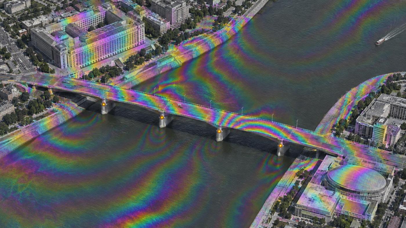
Facility displacement
Fringes crossing a structure flag a candidate.
Choose a period and press Safety → Structure check: public InSAR (GUNW) previews, monthly Sentinel-2 and OpenStreetMap facility outlines are analysed by the same engine.
- Sentinel-1 ARIA GUNW first, NISAR L-band GUNW preview where no archive exists
- Fringes over bridges, embankments or large buildings = line-of-sight displacement candidates
- Tilt and millimetres need the original GUNW product
- A textbook demo case (the Surfside collapse) is built in
More safety tools
Sinkholes and power plants on the same screen
Sinkhole risk score
NDMI, NDBI and NDVI change plus proximity to watercourses, pipes, tunnels and excavation give each cell a 0–100 score in four grades: watch, caution, warning, danger.
Thermal discharge
Sentinel-3 SLSTR sea surface temperature (about 1 km) around outfalls; Sentinel-3 land surface temperature on land.
Exhaust
Sentinel-5P TROPOMI tropospheric NO₂ screens combustion gas from thermal plants. Not stack CEMS.
FAQ
Frequently asked questions
Does it replace statutory safety inspections?
No. It is not a statutory inspection or detailed safety diagnosis. It picks where to inspect first.
Does it find sinkholes directly?
No. Optical satellites cannot see voids underground. It scores cells where risk conditions overlap and does not replace GPR or geological surveys.
How many safety screenings are included?
Each tier has an annual allowance shared by structure checks, sinkholes and power plants.
Related pages
Work with us
Start with a satellite screening of your forests.
Send us your forest boundaries. We screen carbon stock, annual uptake and candidate quality from public satellite data first, then walk through the results with you. No field equipment is needed.