Put the forest next to its look-alikes.
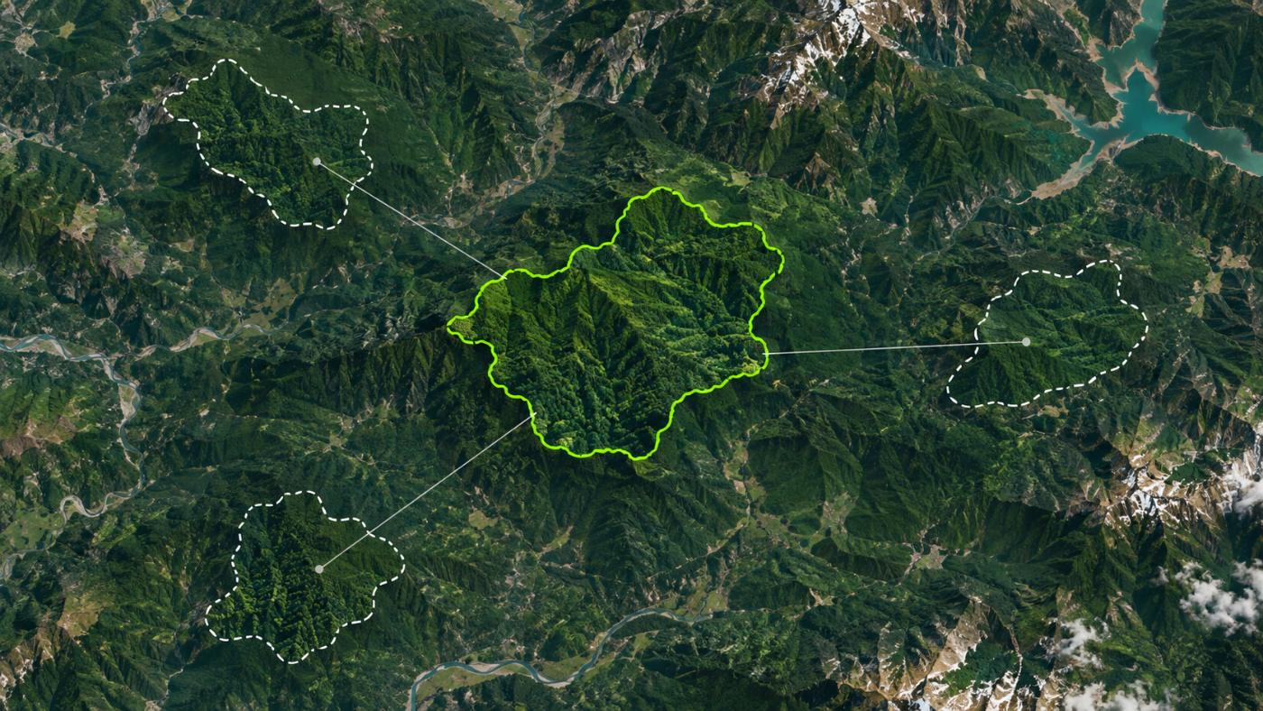
Satellite data from the project site alone cannot show that a project caused the increase. CANOPY builds a dynamic control plot from similar forest outside the site and compares them on the same dates.
How it finds them
Look-alike forest 1–11 km outside the boundary.
Press Environment → Dynamic control plot and candidate points are placed roughly 1–11 km outside the site, scored by Gaussian similarity in elevation, Sentinel-2 NDVI and EGIS stand type.
- Target similarity 0.95, three control plots
- If not reached, the nearest points are used and marked “below 95%”
- Covariate matching, not a generative AI choice
- Re-measuring the site means finding the control plot again
Comparison
Same dates, same method.
Site NDVI and the control-plot mean are plotted on the same Sentinel-2 acquisition dates, and biomass is converted with the same KFS scale to give the gap.
Time-series comparison
See how the two forests differed on the same day, on one chart.
Stock gap
How much more or less is standing than in similar forest, in tCO₂e. Not a quantity proven to come from the project.
Additionality watch
Forests already protected from felling, such as urban forests and nature parks, get an additionality watch even when the numbers look good.
Why it matters
Strong uptake does not make a candidate.
Methodologies such as Verra VM0047 do not accept additionality from project-site satellite data alone. If the forest would have grown anyway, the added carbon cannot be credited to the project.
That is why CANOPY builds a control plot separately from the measurement and flags forests that are already protected. Gwangmyeong Dodeoksan urban forest in the demo portfolio is one example: its uptake is not small, but as an urban forest it carries an additionality watch.
FAQ
Frequently asked questions
What is additionality?
Whether the reduction or removal would not have happened without the project. Credits must pass this test.
Does a person choose the control plot?
No. Candidate points are placed automatically and chosen by similarity in elevation, NDVI and stand type. The result screen shows similarity and location.
Can the comparison earn credits?
No. Registration and issuance go through a standard’s methodology and third-party validation. CANOPY is for choosing candidates beforehand.
Related pages
Work with us
Start with a satellite screening of your forests.
Send us your forest boundaries. We screen carbon stock, annual uptake and candidate quality from public satellite data first, then walk through the results with you. No field equipment is needed.