From orbit to the approval memo.
Optical satellites watch the forest continuously; biomass, carbon stock and annual uptake are delivered to a dashboard and a verification-ready report. Today it runs on free public data only.
Pipeline
Six steps.
1. Register
Draw a boundary on the map or pick a registered site. The address of the centre point is attached.
2. Fetch scenes
Sentinel-2 L2A by default, with any satellites you switch on (S1, ALOS, GEDI) aligned to the same 10 m grid. Registered sites are pre-fetched.
3. Filter quality
Only SCL 4 and 5 pixels remain; cloud, shadow, water and snow are dropped. Too few pixels means the next scene.
4. Compute carbon
KFS stand volume × satellite multiplier gives biomass, carbon and CO₂e; light-use efficiency gives annual uptake.
5. Check and rank
Pre-check verdict, additionality hint, 0–100 priority, integrity grade and uncertainty are attached.
6. Report
Copy the report sentence, download the standard PDF draft and keep it in the measurement history.
On screen
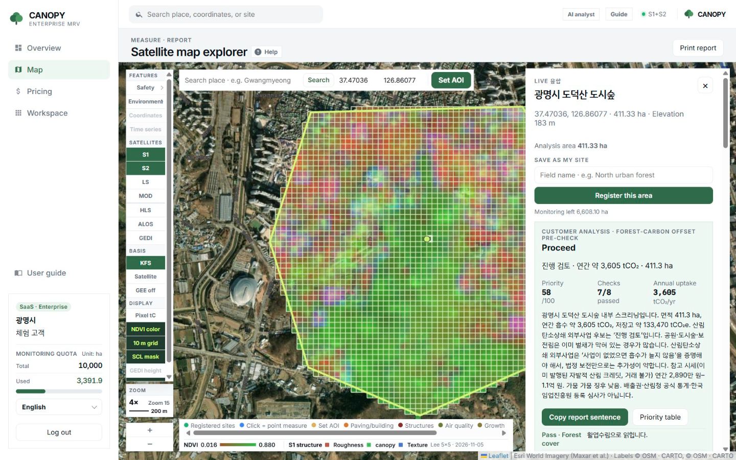
Results stack up in the drawer beside the map.
When a run finishes, the pre-check verdict, priority, checks passed and annual uptake appear at the top of the right drawer, followed by the report sentence and detailed figures.
- Large figures at the top are forest-wide means
- Click a single cell for its NDVI
- Print a report straight away
- Control plot and 10-year series run separately by button
Limits
What it does and what it does not.
What it does
Watch large forests often with one method, estimate carbon stock and annual uptake, screen and rank candidates, compare with similar forest, read ten-year trends and draft documents.
What it does not do
Issue credits, replace official statistics, perform registry review or third-party validation, replace field inventory, measure tree height or diameter directly, or guarantee revenue.
Related pages
Work with us
Start with a satellite screening of your forests.
Send us your forest boundaries. We screen carbon stock, annual uptake and candidate quality from public satellite data first, then walk through the results with you. No field equipment is needed.